50 Bridges

Messages
2,784
Name
Paul
Edit My Images
Yes
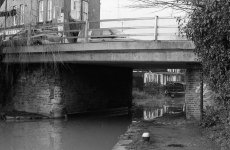
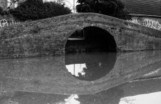
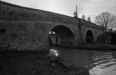
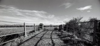
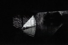
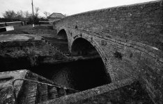
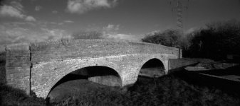
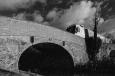
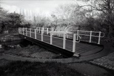
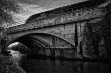
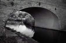
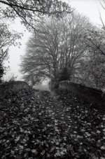
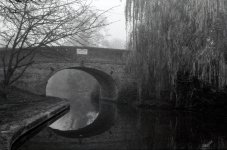
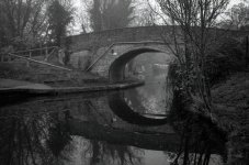
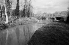
With all due respect to @Ed Sutton whose idea I have stolen. I have set myself a personal project to photograph all the bridges on my section of the Grand Union Canal.

I live in Leighton Buzzard, with my nearest bridge being number 115. The section I have arbitrarily selected is from Bridge 90 to Bridge 140 (Milton Keynes to Tring). My plan is to walk each section of the canal and take a photo of each bridge over the canal, and also any obvious bridges to the side as well. Because I am having a bit of a film re-visiting phase in my life, they will all be shot on film. I will also "try" to present the most attractive view I can of each bridge, avoiding record shots where I possible - sometimes, as you will see, this may mean almost entirely avoiding to photograph the bridge itself.

Any of these "rules" are subject to change at my whim.

I do not plan to dump the whole lot on you en-masse, but drip feed them as and when. I do plan to present them in sequence.

It is also relevant to point out that, despite the title, there will not be 50 bridges. Some bridges have disappeared, leaving nothing more than a gap in the numbers. Others have disappeared leaving a shadow on the canal, which if I spot it, I may include. Conversely, most areas have added new bridges which have (generally) required numbers to be added in.

Lockdown will present a problem. All of the Milton Keynes work was down before this latest lockdown. The next section is local and has been easily done within permitted exercise. But further work on the project will have to wait for lockdown to end.

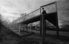
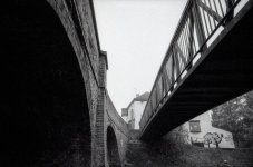
Bridge 90: The start of our journey. A pedestrian bridge near H8 Standing Way, Milton Keynes
Bridge 90.JPG

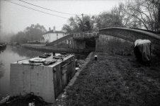
Bridge 90A: I found this modern bridge so unattractive, I ended up photographing the concrete flank wall with some nice dappled light
Bridge 90A.JPG

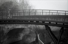
Bridge 90B
Bridge 90B.JPG

Bridge 90C: This image makes me think of some avant garde French cinema. Je ne sais pas pourquoi.
Bridge 90C.JPG

Bridge 91: With a pipe bridge in front and 90C beyond
Bridge 91.JPG

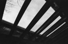
And finally for today Bridge 92
Bridge 92.JPG
 
90c is made super by the swan, and the light coming through 92 is really quite nice.
Great series Paul and a fab idea. As a long time CRT member I do enjoy time by the canals and rivers.
 
Last edited:
Good ideas are always worth appropriating. Like I did. ;)
 
90c is made super by the swan, and the light coming through 92 is really quite nice.
Great series Paul and a fab idea. As a long time CRT member I do enjoy time by the canals and rivers.

Thanks Ian! The canal is very important for my mental and physical well being.

Great light coming through 92, but there is rubbish brickwork under there!

Good ideas are always worth appropriating. Like I did. ;)

Thanks Dave!
 
Continuing South. Bridge 92A
Bridge 92A.JPG

Bridge 93
Bridge 93.JPG

Bridge 93A with some quite nice light underneath
Bridge 93A.JPG

Bridge 94 with a Swan departing the frame (judge bait)
Bridge 94.JPG

Bridge 95 - the strangest arrangement I have ever seen, with a swing bridge over the middle of a lock
Bridge 95.JPG
 
Like the swan theme. You need to take one around with you to all the bridges to add cohesion.

You've got some really nice lighting on some of these (93 & 93A in particular)
 
And we're back...

Bridge 95A (interesting only in that a railway bridge needed an A suffix, but life is too short to wonder about that for long)
Bridge 95A.JPG

Bridge 96
Bridge 96.JPG

A marina bridge at the side of the canal (i.e. the towpath goes over a side branch)
Bridge 96A.JPG

Bridge 97 with a pipe bridge with some nice curlicues
Bridge 97.JPG

A very boring picture of Bridge 98 (nothing to see here, move along)
Bridge 98.JPG

And finally for today Bridge 98A (or at least a snippet of it)
Bridge 98A.JPG
 
It's interesting to see the contrast between the bridges that clearly (in my inexpert view!) required some skill in bricklaying and design, whilst others are just big lumps of concrete.

Lack of swans is noticeable. Pedalo, inflatable or otherwise. (Made up for in your 52 though)
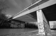
 
required some skill in bricklaying and design, whilst others are just big lumps of concrete.
I am inclined to agree with you in general. But concrete can be produce an attractive bridge when used with a bit of flair. A couple of examples come to mind:

Millau Viaduct (image from www.ila-chateau.com)
Millau Viaduct.jpg

Greta Bridge, Keswick (image from happypontist.blogspot.com)
Greta Bridge.jpg
 
Time to continue our canal walk.

Bridge 99, together with a pipe bridge
Bridge 99.JPG

Bridge 99A marks the southern edge of Milton Keynes (or at least that's how I think of it, the locals probably think otherwise)
Bridge 99A.JPG

And now we start a section with some gappy numbering (which is a bit odd, given we are in the countryside). I could find no trace of the missing numbered bridges. I have not been able to find out when the bridges were numbered, but even if it were a long time ago, to have quite so many rural bridges vanished is a bit odd.
So, our next bridge is 102 (not in very good condition, but still an active road bridge for a minor road)
Bridge 102.JPG

Then another gap, to Bridge 104. This is the first double arch bridge we have encountered in our journey (but not the last). The story is that the Grand Union Canal, or Grand Junction Canal, as it was probably known at the time, has planned to double up the locks to cope with the heavy traffic levels. Locks are a major delay in the network and numerous measure have been used over the years to both speed up the process, and also save water (every lockfull, plus leakage, has to be supplied to the top level, or summit level, generally by pumping it up there). But there is no evidence in my area of any of these double locks ever having been built. That makes me suspect that this plan was started sometime about the start of the railway expansion, but abandoned by the time railways were taking substantial freight traffic.
Bridge 104.JPG

Then on to a dead swing bridge 105, along with a newly acquired inflatable canoeist. You can just see the remains of the swing bridge on the far side.
Bridge 105.JPG

Bridge 106 is a rather nasty concrete job, built in top of the remains of a former brick bridge, from this angle we can see a little of the old brickwork rising up around the roving steps. You have to rove under, around, then over the bridge if you are with a horse towing a barge when the towpath crosses from one bank to the other to avoid the line getting tied up with the bridge.
Bridge 106.JPG

Then we go on to the Three Locks: pub, locks (obvs.) and this horrid bridge, number 107. I felt this bridge was so unredeemably ugly, the only way I could improve it was to make it very small in the frame, hidden behind the much more interesting side-pond.
Bridge 107.JPG

Bridge 108 (nearly finished for today)
Bridge 108.JPG

And finally, I will leave you today with my favourite bridge, number 109. I regularly walk past this, and it often is very pleasant. It is an accommodation bridge, built to pacify a landowner when the canal was first built. But it has long been left unused by whoever owns the land now, so there is more vegetation growing on the bridge than on most of the surrounding land. Because I like this bridge, and I can, I shall post three pictures of it.
Bridge 109.JPGBridge 109-2.JPGBridge 109-3.JPG
 
Just a short stroll today.

Starting with Bridge 110, known in old books as Sandhole Bridge. Is this a reference to a sand and gravel pit nearby? Leighton Buzzard owes a lot to sand and gravel extraction, so it is quite likely. Just visible through the bridge is an old wharf (where the van is parked), which suggests something was regularly loaded or unloaded here, and this is only a tiny hamlet.

Bridge 110.JPG

Then Bridge 111, a fairly ugly modern piece of work. You may be wondering about the broken pipe dangling below the bridge, held up with rope. So far as I can tell, this is the mains electrical supply to the canalside pub just behind us.

Bridge 111.JPG

Bridge 112 is a long abandoned swing bridge
Bridge 112.JPG

There is even less left of Bridge 113. Here's where it was, just beyond the inflatable duck.
Bridge 113.JPG

Finally for today, not a bridge at all, but the Twelve Arches Weir
12 Arches Weir.JPG
 
Another nice series of images. Do you think you'll stick to the 50 bridges? How many have you done now? And finally, do you have a desired output for this? (book, zine, collage print etc)
 
Another nice series of images. Do you think you'll stick to the 50 bridges? How many have you done now? And finally, do you have a desired output for this? (book, zine, collage print etc)
Thanks Ian!

I hope to stick with it to the end. I'm drip feeding the material I have, hoping to make it last through to the end of lockdown. I have walked, and photographed about two thirds of the total. I've inflicted almost half of the total on the long suffering public.

I have given no thought at all to what an end result might be... I'll ponder on that. I have been following your zine project of late. Mostly it was just an excuse to walk with a camera - then lockdown stopped that.
 
Oops! There was a bit of a delay there... not sure if anyone noticed... only about 20 months. General stuff got in the way.

It is still my intent to take a halfway decent image of each bridge from number 90 to number 140 and post them here. Here are the next couple.

Bridge 114, a nasty concrete road bridge built on top of an older brick one (not much I could do with this)
Bridge 114.JPG

And Bridge 114A, allowing the towpath over what would have been a side canal serving a wharf for local businesses. The side canal is now filled in and a car park.
Bridge 114A.JPG
 
Now we have a set of bridges that could be collectively known as 115. The actual numbering is all rather random. I can't offer any sensible explanation, but will just present them in sequence from North to South.

Just a quick recap, for any new viewers (where were you?), these are all taken on film. I think they have all been on HP5+ so far (at a variety of ISOs), with an EOS 1v.

Bridge 115, a pedestrian bridge built I presume when the 1970s estate next to it was built (visible in the background).
Bridge 115.JPG

Bridge 115A, a former railway bridge, half abandoned and half pedestrianised (I prefer the abandoned half).
Bridge 115A.JPG

Bridge 115C, the most modern of this set. A canal festival is held in this area each year, and they used to built a temporary bridge each time only to remove it a few weeks later. Several years back they decided to build a permanent bridge. Sadly from this angle, you don't see the rather nice curved top to the steel structure.
Bridge 115C.JPG

Two for the price of one (sort of). In the background Bridge 115C (now showing the curved steel), in the foreground an abandoned swing bridge which would probably have been the oldest of this set, but now denied any number. So youngest and oldest side by side.
Bridge 115x.JPG

And finally for this set, Bridge 115B, a modern road bridge for the bypass.
Bridge 115B.JPG
 
We're now South of Leighton Buzzard; the canal is mostly in the middle of nowhere, and all the more pleasant for that.

Bridge 116, a double arch bridge, but unlike Bridge 104 above (https://www.talkphotography.co.uk/threads/50-bridges.720832/post-8897677) I don't believe this was a double arch to accommodate a future double lock; instead the far span is for some water overspill - a rather generous culvert.

Bridge 116.JPG

Bridge 118, a humble farm accommodation bridge that has previously defeated my attempts to get a halfway decent picture, so this time I went up on top.

Bridge 118 (2).JPG

Bridge 120, a concrete bridge so drab that I photographed the light reflecting on the ripples instead.

Bridge 120 (2).JPG

Bridges 121 and then 122, back in legitimate double arch territory.

Bridge 121.JPG

Bridge 122.JPG
 
Not sure if this is of any assistance with your gaps (and I may be teaching your grandmother to suck eggs)

e.g. No 100: Chambers Bridge


There's a bunch of information there including maps and photos. It notes 'There is no access to the towpath here' which might help explain why you didn't encounter it.
 
Last edited:
Not sure if this is of any assistance with your gaps (and I may be teaching your grandmother to suck eggs)

e.g. No 100: Chambers Bridge


There's a bunch of information there including maps and photos. It notes 'There is no access to the towpath here' which might help explain why you didn't encounter it.
Thanks Rob, that might be useful material in general.

If you are suggesting the link might explain the missing bridge 100 I discuss above, I'm not convinced it helps us. The link is relevant to the Oxford Section of the Grand Union. I am walking and photographing the main part of the Grand Union passing through Leighton Buzzard and surrounding areas, which this publication describe as "Grand Union Canal ⇨ Grand Junction Canal ⇨ Main Line ⇨ Gayton to Brentford" (I never knew there were all these different sections until now).

Of the relevant section (https://canalplan.uk/place/2sls), they too provide no clue as to our missing bridges 100 and 101. They describe 99A and 102 as I did, but no comment about the gaps.

So, still a mystery! All the more so as that part of the canal is in a peaceful rural location. The most likely explanation is they were swing bridges which fell into disuse (many such do) as farming practices changed and they were ripped out leaving no trace.

But thank you for the link and I will refer to it in future.
 
Gracious, the Grand Union gets far more complicated than I had appreciated from the London end that I'm familiar with (and more so the Regent's Canal)
 
Thanks Rob, that might be useful material in general.

If you are suggesting the link might explain the missing bridge 100 I discuss above, I'm not convinced it helps us. The link is relevant to the Oxford Section of the Grand Union. I am walking and photographing the main part of the Grand Union passing through Leighton Buzzard and surrounding areas, which this publication describe as "Grand Union Canal ⇨ Grand Junction Canal ⇨ Main Line ⇨ Gayton to Brentford" (I never knew there were all these different sections until now).

Of the relevant section (https://canalplan.uk/place/2sls), they too provide no clue as to our missing bridges 100 and 101. They describe 99A and 102 as I did, but no comment about the gaps.

So, still a mystery! All the more so as that part of the canal is in a peaceful rural location. The most likely explanation is they were swing bridges which fell into disuse (many such do) as farming practices changed and they were ripped out leaving no trace.
Have you tried old maps as can be found at the National Library of Scotland? https://maps.nls.uk/geo/explore/#zoom=16.3&lat=51.94198&lon=-0.69787&layers=168&b=1
 
Thanks Dave, what an excellent idea!
I spend hours on there! I'll be on again later looking at some old workings I came across on the moors today.
 
I spend hours on there! I'll be on again later looking at some old workings I came across on the moors today.
Some time later.... I had a good look over those, and they confirm that the missing bridges were simple swing bridges in the middle of farmland.

My guess is that the original deal was that the canal company built and maintained the accommodation swing bridge but the farmer had to keep it in good order and accessible. When the farmer let his side slip, out it came.

The interesting question is why most accommodation bridges were swing bridges, but some got proper brick bridges. A much higher proportion of those type are still around today, even where the access is overgrown. Perhaps it was to do with how prepared you were to get lawyered up.

Many thanks for the link.
 
More rural ramblings...

Bridge 123, a very small bridge used by some very large vehicles (hence the parapet has had to be rebuilt).
Bridge 123.JPG


There is no sign of any bridge 124, so it's straight on to Bridge 125, a rural swing bridge. Few of these swing bridges are still in existence, let alone operation. A canal boat owner I chatted to recently, when I made this observation, said "a bloomin' good thing too!" I like the way the paint has been totally worn off the handrail by many years of pushing and pulling.
Bridge 125.JPG


Bridge 125 can also be seen again in the background of the next image, Bridge 125A, the West Coast Mainline. The railway bridge, although concrete, is a rather nice skew bridge. It would have been quite a sight in brick, but is quite pleasant in concrete, if you can see past the staining (which is a bit of a tall order). I felt a bit of gritty treatment might be add some interest (No? Oh well, please yourselves).
Bridge 125A.JPG


As an aside, the modest swing bridge having the number 125 and the West Coast Mainline bridge having number 125A gives us an idea of when the bridges were numbered. The canal here, originally the Grand Junction Canal, was completed by 1800. The London and Birmingham Railway (as the West Coast Mainline was then called) was completed by 1837. Therefore we can be reasonably confident the bridge numbering was very early.

Bridge 126 is another quiet rural road bridge with a little marina beyond it called Pitstone Marina.
Bridge 126.JPG


A bit of a gap to the next bridge now, so best foot forward!
 
And off we go, on a foggy day, continuing South on our pontal journey (that's a real word according to t'internet, but not my dictionary).

Bridge 129 is a very pleasant accommodation bridge. I popped up on top for a bit of variety. There are no signs of bridges 127 or 128.
Bridge 129.JPG


Bridge 130 is on the edge of the village of Marsworth.
Bridge 130.JPG


The canal curls around Marsworth, so Bridge 131 is still on the edge of that village.
Bridge 131.JPG


Past the entrance to the Aylesbury Arm, a side canal that runs about six miles West to Aylesbury. I have decided that my next project will be to walk and photograph that canal, but with an altogether more relaxed, less bridge-y, attitude. Now two for the price of one, an unnamed modern footbridge on the right, and Bridge 132 on the left, with a dead pub in the background.
Bridge 132.JPG


Now the canal loops sinuously around the Tring reservoirs, built to feed the summit level of the canal. Canals are thirsty beasts, and keeping the water flowing in at the top has always been a problem to canal engineers and operators.

A bridge, but this one doesn't count, and shouldn't really be in this project. This is Bridge 1 of the Wendover Arm, another side canal to the Grand Union that used to run about six miles South West to that town. It was not a success, and leaked its way for a little over a hundred years before being abandoned in 1904. More recently efforts have been undertaken to re-open it. I plan to explore what is left there now as a future project.
Wendover Arm.JPG

Another two for the price of one, and another modern footbridge with an earlier road bridge beside it. Bridges 133 and 133A, although all too blended together into one in this picture. Also home to the Grand Junction Arms, a fine pub.
Bridge 133.JPG


That's it for today, the next stretch is the Tring Summit section, a rather different beast.
 
Only just noticed this with that last image, but some of these photos are timeless and others have elements in them that make them clearly 21st century. Many of them are one or the other, but the last one blends the two together really well.
 
Only just noticed this with that last image, but some of these photos are timeless and others have elements in them that make them clearly 21st century. Many of them are one or the other, but the last one blends the two together really well.
Yes Ian, I think that is one of the things which appeals to me about this project. One minute I could be one, or even two, hundred years in the past. The next minute bang up to date. The next section is very much in the former camp.
 
I look forward to learning more!

I live in Bristol, but village scenes. Sounds quite broad I know, but I want to be fussy over them, so the same crop ratio etc The plan is maybe a book as the end goal. Even if it's just a book for myself! Another reason behind it is to stop visiting the tourist shots (ie Clifton Suspension Bridge, etc) see some nice little villages, it's somewhere we can both enjoy and take the dog, plus if we can support a local pub or cafe or farm shop whilst out even better.

I'm at the editing stage of the first few images right now.
That sounds an excellent project. I know the area a little, and there are some cracking areas around and about. I shall be interested to see whatever you choose to post. Good luck!
 
You've probably got a similar link but I've found https://www.oldmapsonline.org/ very useful for finding where things used to be. Can take a bit of fiddling to see exactly where things were and the site could be easier to navigate but still a useful resource. Can't remember who put me onto it but I'm fairly sure it was someone here!
 
You've probably got a similar link but I've found https://www.oldmapsonline.org/ very useful for finding where things used to be. Can take a bit of fiddling to see exactly where things were and the site could be easier to navigate but still a useful resource. Can't remember who put me onto it but I'm fairly sure it was someone here!
Thanks for that map link Nod, excellent ;)
 
Back
Top