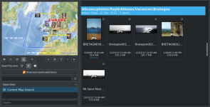
seeing all photos taken on a map (based GPS tag)

Messages
2
Name
daniel
Edit My Images
Yes
hey i used to use acdsee for that feature but this software is sucks,
what software can do it? display all photos on a certain folder on a map?
not just one photo, but selecting few folders, while the software displays them all together on a map.
 
Lightroom can do this. Google Photos will read GPS tags and show you where photos were taken too.
 
Lihtroom Classic. Please bear in mind that this feature no longer works on older versions as it uses Google Maps and Google charge Adobe who could not really continue to pay Google for old versions as they had no income from those.

Dave
 
you mean adobe photoshop lightroom?
Adobe Photoshop Lightroom Classic which, because it uses Google Maps, you can zoom right in as well as a wide view. While this is an interesting novelty, I have not found any real use for it for me.

Dave
 
Back
Top