
- Messages
- 5,826
- Name
- Mike
- Edit My Images
- Yes
Hi Guys
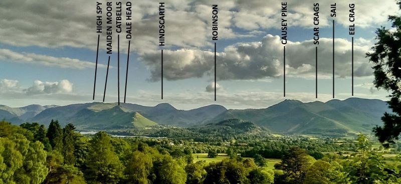
Hoping that one of you can put me out of my misery and name the mountain behind the trees to the left of Catbells
I'm thinking it could be Hindscart as it appears to lie between Catbells and Causey Pike.
Any other suggestions?
Much appreciated
Mike
 Pre-Dawn, Derwent Water by Mike Stephen, on Flickr
Hoping that one of you can put me out of my misery and name the mountain behind the trees to the left of Catbells
I'm thinking it could be Hindscart as it appears to lie between Catbells and Causey Pike.
Any other suggestions?
Much appreciated
Mike
Pre-Dawn, Derwent Water by Mike Stephen, on Flickr
")
 Derwent Water


 This may prove to be an invaluable resource!