Geotagging question – what software / website / service do you use?

Messages
574
Name
Gary
Edit My Images
No
I have just started using my GPS device with my camera to tag the location of the pictures that I take, but I am looking for a solution to link the pictures to the location for viewing on the internet.

I am happy that the EXIF is recording the location properly, I have put some pictures on Panoramio, but they don’t seem to be locating.

So my question is – What programs or websites do you photographers that geotag, use to display the location of there pics?

Any help is appreciated,

Thanks

Gary
 
Never considered geotagging m8 sorry.
 
I tag some of mine using the Map on Flickr. Seems to do the job. If the location data is present in the EXIF though, there's not a lot else you need to do is there?
 
Thanks for the info.
I suppose that what I am after is a way of embeding a page or program into my website, that allows customers to click on an icon on a map, that shows only my pictures, and they can then browse that page based on where the pictures where taken, eg Jerez, Silverstone etc.
I realise that I could just put them in folders for that event (which is what I do) but I often get asked "which corner was that taken from?" so having the ability to do that automatically on my website is what I am after.
I realise that I could duplicate my whole website onto Flickr / Panoramio, but that wouldn't be practical - I just need something to intergrate into my site.
Cheers
Gary
 
Sounds like you need something like the Google Maps API if you want it seemlessly integrated. That may well involve some programming on your part though...
 
I use a Garmin 705 GPS to record location data when I'm out and about taking shots. At the end of the day, I import the tracklog from the 705 and save a copy of it to the same directory I dump my day's photos into. I then run a free program called Geosetter which basically merges the location data into the photo's on a time basis. The GPS picks up the time from satelites, so all you have to do is ensure that your camera is set to the correct time and data and Geosetter will do the rest. I then continue with my normal workflow of backing up to external HD followed by importing to Lightroom etc... When the files come into lightroom the EXIF has already got locaton details in place, shots exported to Flickr are automatically picked up, it really is that easy!

Edit: sorry - didn't read the original question - just went by the title and jumped straight in :shrug:
 
I see that flickr can do tagging to the map, but it isn't going to be practical to duplicate my entire website to flickr.
I might just have to do a seperate gallery for each job, but that is extra work that I don't do, and doesn't tie in with my site................hmmmm.........decisions

I shall have a look down the Google Maps API route

Thanks guys

Any more suggestions?
 
Yes, here's another :)

google's picasa - may not be quite what you want, picasa scans your hard disc and leaves all the images where they are but arranges then into folders- usual thing you can have albums, tag, stars. You can also upload and then drag thumbnails onto a world map. By zooming in you can drop the marker on the exact spot. Takes a bit a of time but IMHO it builds into a very nice facility.
I've done quite a bit of work with the google maps API, it improved my javascript no end. I did one that has all the lake district fells coloured according the height bands, I'd better not post a link as it could be considered commercial :)
 
Had a quick look at the Google API - from one of the demo files I changed something like 3 parameters and plugged in the co-ordinates from my photo's exif and got a map with pushpin who's location was spot on... nearly fell off my chair! Can't remember when some code I'd meddled with worked first time...

Now all i need to do is work out how to read exif's from within the javascript:thinking:

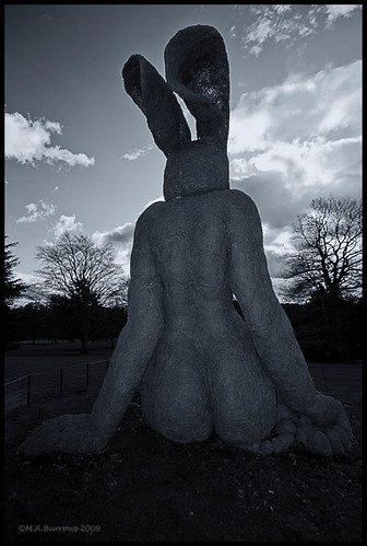
Photo...


Map...
clicky

if you change to satelite view and zoom in, you can see the statue... Cheers JimR
 
If, I'm understanding your question correctly - Geosetter for me. Adds the gps info to photos and shows a Google map or sat image of the location.
 
Back
Top