- Messages
- 10,409
- Name
- John
- Edit My Images
- Yes
This is the first-named storm of the season. Here's a link to 'Walesonline' published at 1152. The storm is now classed as 'a danger to life' for parts of Wales and a yellow alert is in place for the whole of Wales for tomorrow and Thursday https://www.walesonline.co.uk/news/wales-news/met-office-upgrades-storm-agnes-27787998
It seems that the Met Office are having difficulty forecasting exactly where the storm will hit in the UK. The whole of Ireland is in line for dangerous conditions, though.The storm is an offshoot of ex-tropical storm Ophelia which hit the US east coast last weekend into the early part of this week.
Its track with explanation: https://www.met.ie/storm-agnes
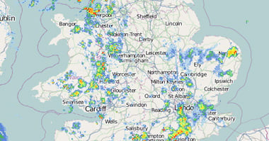
My barometer is reading 1027 at the moment, heavy rain. At present storm Agnes is out in the Atlantic west of the Bay of Biscay but as it nears the SW of Ireland and UK it makes a turn north crosses the Jet stream (140mph approx) and the pressure drops rapidly. I heard one forecaster say it was a weather bomb":..ie the central pressure of the storm falls 24 mb in 24 hours The official name is 'explosive cyclogenesis'. Winds of 80/90 mph by 9.00am tomorrow off the SW of Ireland. They think it will 'fill' (central surface pressure rises) as it makes landfall in SW Ireland which will lessen the winds..relatively..to 60/75 mph. The worst for Wales and the NW of England will be around 5.00pm tomorrow.Winds of 70-85mph are forecast as the storm travells through the narrow St Georges Channel so Anglesey will be affected badly. Really, from just south of Cardigan Bay (St Georges Channel) through the Irish Sea into the North Channel. Belfast-Larne and in Scotland Stranraer. Draw a line from Plymouth through Cardiff to Hull and the highest winds are west and north of that. It's through by late Wednesday evening.
It's not just the wind,it's heavy rain and Wales is forecast to be hit tomorrow afternoon (4.00-5.00pm)with a heavy band travelling through Cornwall and Devon,too right through the evening but the heaviest rain will be Carlisle north.The SE won't be so affected. It could have been a lot worse for more of England had it tracked a little further east from the outset. There's another Low developing on Thursday evening which will make landfall in Cornwall about 1600..Very heavy rain and strong winds. Friday High Pressure develops over the weekend but doesn't last.
Hopefully, we'll see some great photos from those who live on or near the coast....safety allowing of course. I've seen some impressive photos/videos from Aberystwyth front during storms like this one. Barra (Dec 7 2021 and Eunice February 17th last year
It seems that the Met Office are having difficulty forecasting exactly where the storm will hit in the UK. The whole of Ireland is in line for dangerous conditions, though.The storm is an offshoot of ex-tropical storm Ophelia which hit the US east coast last weekend into the early part of this week.
Its track with explanation: https://www.met.ie/storm-agnes
My barometer is reading 1027 at the moment, heavy rain. At present storm Agnes is out in the Atlantic west of the Bay of Biscay but as it nears the SW of Ireland and UK it makes a turn north crosses the Jet stream (140mph approx) and the pressure drops rapidly. I heard one forecaster say it was a weather bomb":..ie the central pressure of the storm falls 24 mb in 24 hours The official name is 'explosive cyclogenesis'. Winds of 80/90 mph by 9.00am tomorrow off the SW of Ireland. They think it will 'fill' (central surface pressure rises) as it makes landfall in SW Ireland which will lessen the winds..relatively..to 60/75 mph. The worst for Wales and the NW of England will be around 5.00pm tomorrow.Winds of 70-85mph are forecast as the storm travells through the narrow St Georges Channel so Anglesey will be affected badly. Really, from just south of Cardigan Bay (St Georges Channel) through the Irish Sea into the North Channel. Belfast-Larne and in Scotland Stranraer. Draw a line from Plymouth through Cardiff to Hull and the highest winds are west and north of that. It's through by late Wednesday evening.
It's not just the wind,it's heavy rain and Wales is forecast to be hit tomorrow afternoon (4.00-5.00pm)with a heavy band travelling through Cornwall and Devon,too right through the evening but the heaviest rain will be Carlisle north.The SE won't be so affected. It could have been a lot worse for more of England had it tracked a little further east from the outset. There's another Low developing on Thursday evening which will make landfall in Cornwall about 1600..Very heavy rain and strong winds. Friday High Pressure develops over the weekend but doesn't last.
Hopefully, we'll see some great photos from those who live on or near the coast....safety allowing of course. I've seen some impressive photos/videos from Aberystwyth front during storms like this one. Barra (Dec 7 2021 and Eunice February 17th last year
Last edited: